
Gilsland straddles the county boundaries of Cumbria and Northumbria and features some of the best bits of Hadrian’s Wall we have seen so far on our expeditions.
Following our visit to the Cumbrian end of Hadrian’s Wall at Bowness on Solway, we thought we should travel up on to the fells and see what the wall actually looks like in a natural setting.

Travelling along the A69 towards Newcastle, we turned left into the village of Gilsland and found a free car park with about 25 spaces. Dad commented that the parking area was maintained, according to a sign at the car park entrance, by Carlisle City Council. Carlisle is about 30km (18 miles) away.
Mum and dad put on their trampling boots and we were off across the road and into a big field.
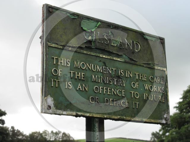
To our right was the first glimpse of Hadrian’s Wall and a slightly shabby information panel, which turned out to be slightly out of date.
Willowford East Turret
Emperor Hadrian ordered the wall to be built between the west and east coasts of Britain following a visit to the area in AD122.
Built as a demarcation line between the Roman Empire and the rest of the world, it provided a physical symbol of power and control.
With the sun shining and the grass slightly damp from overnight dew, we soon came across our first structure, the ruin of the Willowford East Turret.

At every mile along the wall are ‘Milecastles’ which housed approximately 60 men, and between each milecastle, two turrets at one third of a mile intervals.
These structures provided a lookout position and a relay station for messages to be passed along the fortifications using fire beacons and torches.
From the turret, the wall continues west following the contours of the land.
Previous parts of the wall we have visited have looked quite random in construction. However, in this area all the external stonework has been shaped and a block work construction can be made out.

The internal cavity of the wall is filled with random stone and possibly it is the remains of this we have confused with the finished wall in other places.
Mum estimates that the wall is about 2.5 to 3m wide and appears to have a narrow strip of stonework, like a path at the base.
This narrow strip of stones seemed too narrow to walk along so seemed a bit unusual. Maybe the wall was going to be wider but the engineers decided not to build on the already laid foundations.
Willowford Bridge
Our path dropped down past the Willowford B & B and on to the flat fields alongside the River Irthing.
A small, quite insignificant plaque cemented in to the wall of one of the farm buildings indicates a stone masons mark.

Two courses above and quite hard to read on the dark stone, is text engraved by the chief stonemason for this section of Hadrian’s Wall, Philipus of the Fifth Cohort.
Down the fifty or so stone steps and you enter a larger construction which form what remains of the Willowford bridge.
Due to natural changes in the flow of the River Irthing this structure is now quite a distance from the river of today.
The first crossing of the river at this point was made as part of the building of Hadrian’s Wall around AD122. It is thought that this bridge was destroyed by flooding within 40 years of construction.
A second bridge was constructed on the same site and included flood sluices to try and remove the risk of damage during floods.
The sluices are just the right size for us to investigate and would be great as dens for boys to play in.

Increasing trade and vehicle movements along the road known as the Military Way, required that the bridge be widened and a ramp installed and this became the third version of the bridge.
Modern Willowford Bridge
Built in 1999 the modern Willowford bridge or River Irthing footbridge, is made of steel with a wooden platform and crosses the River Irthing a few hundred metres from the site of the old stone bridge.
It was opened by the Chairman of the Countryside Agency, Ewen Cameron on the 13 July 1999 at a cost of £160,000
The bridge also won a Institute of British Architects regional architectural award in 1999.
A helicopter was used to fly in parts of the bridge to the remote location. This was the first time the River Irthing had been bridged since the Roman Period.
The span is 42 metres and was designed by Christoph Rainford. The main contractor for the works was John Laing Construction.
For all those walkers entering this stretch of the Hadrian’s Wall Walk – remember the information panel at the start of our walk indicated that you could not cross the river, well this bridge proves that you can, so don’t panic.

The information board must have been installed pre 1999 and has not been updated.
After a quick paddle and a drink in the river, which had a dark peaty colour, we returned along our path back to the car for a bite to eat.
Gilsland
Refreshed and watered, we start our second walk this time by heading towards the village, on the lookout for a toilet for the two leggers.
Following the road into the village, we passed the Methodist church and then the sign indicating we were leaving Cumbria and entering Northumbria.
With no sign of any loo’s for mum and dad and not wishing to take advantage of the local cafe, House of Meg, without buying anything, we continued our walk this time in a new county.
Opposite the Silver Jubilee seat in the centre of the village dad spots a wooden marker post and our second journey begins down the side of some houses.

This path is a little muddy and seems to be one of those frequented by the locals. Our walk takes us alongside a few gates which appear to have wildlife habitats on the other side. We are unsure if these are the backs to houses so don’t venture through in case we may be trespassing.
Stepping stones
After about 20 minutes we spot some stepping stones in the river below us. This is our first experience of these so we are eager to try them out. Charlie is the bravest, so he works out what needs to be done to cross over the river without getting wet.
Dad decides that we don’t need to cross the river but to continue our walk on this side.
Past fields of sheep and through many tight kissing gates we emerge into a farm yard called Irthing House.
After saying hello to the friendly dog sitting in the yard, we turn right on to the farm road and head down the hill, back towards the village.
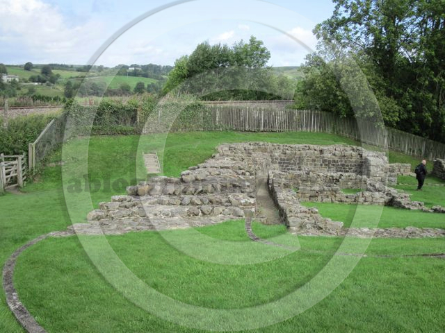
Dad spots a sign indicating the Poltross Burn Milecastle is not far away and after passing over the Poltross Burn we climb the hill to the extensive remains.
Poltross Burn Milecastle – Milecastle 48
This is one of the best preserved Milecastles built by the the Sixth Legion. It was occupied until the fourth Century AD.
An artists impression of how the fort would have looked, indicates that it straddled a path with the main gate house forming part of Hardian’s Wall.
Poltross includes an oven, a stair to the rampart walk, and the remains of its north gateway.

Locally the fort is known as The King’s Stables – derived from an Arthurian legend.
Built in to the natural slope, it must have been a formidable defensive structure.
We exited the site following the line of the railway, along a path fitted with erosion matting. I found this hard work as my feet got caught down the holes. I soon worked out that if I stayed to the edge, in the grass, it was ok.
Not long to go now as we returned to the car following the path to the rear of Gilsland School.
Gilsland Toilets
For information, Gilsland seemingly has some new toilets at the Village Hall. Opened in 2003 at a cost of £14,000. We think they could do with some more notices indicating they are available and maybe details on the information board at the car park.
Until next time
Buster and Charlie
Hi.
Enjoyed this blog entry.
Gilsland is in the Carlisle City Council area – it makes Carlisle a bigger city than the city of London (the famous square mile).
Gilsland is only 17 (not 30 miles) from Carlisle.
HTH
Buster – thanks for the note re distance – now that would be a long walk for a Roman soldier into the city. We have tweaked to include Km and miles.